Geospatial · Environmental Policy · Independent Project
Floodlines
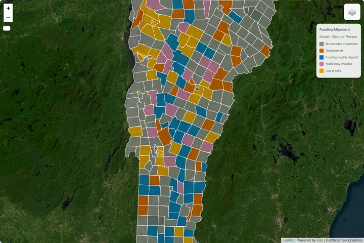
Vermont flood risk and federal hazard-mitigation funding — a geospatial analysis of whether FEMA dollars reach the communities that face the greatest flood risk and social vulnerability.
Built using Python, GeoPandas, and spatial analysis across FEMA flood-risk, insurance claims, Census demographics, and municipal datasets. An interactive Leaflet/D3 dashboard lets users compare definitions of need, examine funding gaps, and explore results town by town.
PythonGeoPandasLeafletD3.js
Shapelyscikit-learnCensus/ACSOpenFEMA